Insurance
Enabling carriers and reinsurers to seamlessly integrate geospatial data into their decision making
Case study
Hurricane Idalia

Clarity for accurate and immediate reserving estimates


Verify, triage, and settle claims quickly with access to real-time data
Portfolio insights delivered to your Claims Management System
Decrease loss ratio and increase reserving accuracy
Triage resource allocations to areas with significant damage
Reputation management for policyholders and the industry
Case study
Hurricane Ian

Reserving
Getting answers quickly

Before
Fathom’s 1 in 200 year flood risk map identifies 10% of the carrier’s policies to be at risk of flooding.

Sept 23
93% of the carrier's properties identified in path of NHI 5 day forecast cone.

Sept 27–28
Previsico hourly flood warning maps show 62% of the carrier's policies at risk of surface water flooding & 50% at risk of sustained flooding.

Sept 28
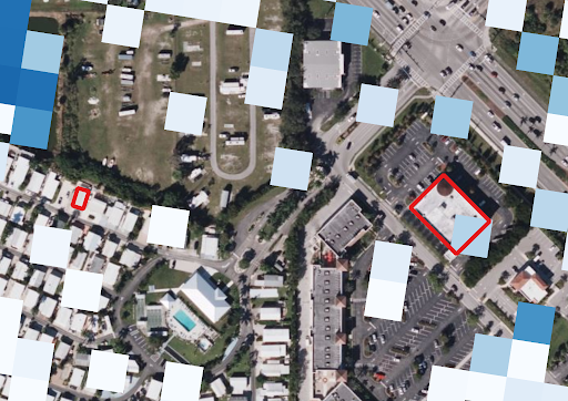
Initial ICEYE flood depth data is available for download. 89% of the carrier's policies covered with 25% experiencing some level of flooding.

Sept 28
Reask wind gust data becomes available. 91% of the carrier's policies are covered with 26% experiencing wind gusts over 120 mph.

Sept 30
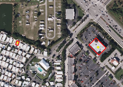
GIC post disaster graysky aerial imagery available for download.
Harness earth observation data to revolutionize the insurance lifecycle.
Talk to an expert to learn how you can easily access and use geospatial data.